Subtitles & vocabulary
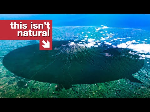
The Circle Visible From Space
0
林宜悉 posted on 2021/12/31Ever wondered about a volcano that's also a legal person? This video dives into Mount Taranaki, exploring its stunning symmetrical shape, its history with Māori land rights, and the fascinating concept of its legal personhood! You'll pick up advanced vocabulary related to geology and cultural depth, all while enjoying incredible aerial views.